Research
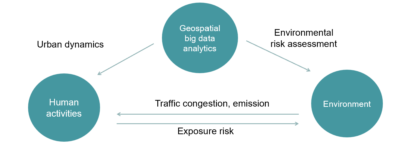
Based on human/vehicle trajectory data, my research develops analysis methods that consider spatial constraints and spatial heterogeneity to comprehensively analyze and understand human dynamics in a fine-grained level. By incorporating these factors into my research, I aim to gain insights into urban dynamics and how human behavior and movement patterns are influenced by the surrounding spatial context.
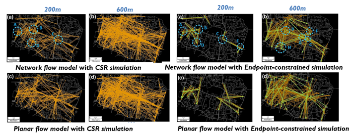
Zhao, Z., Kan, Z., Kwan, M.P. and Tang, L., 2025. Identifying urban spatial clusters via flow dynamics: a coupled tensor-based method. International Journal of Digital Earth, 18(1), p.2525382.
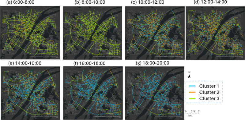
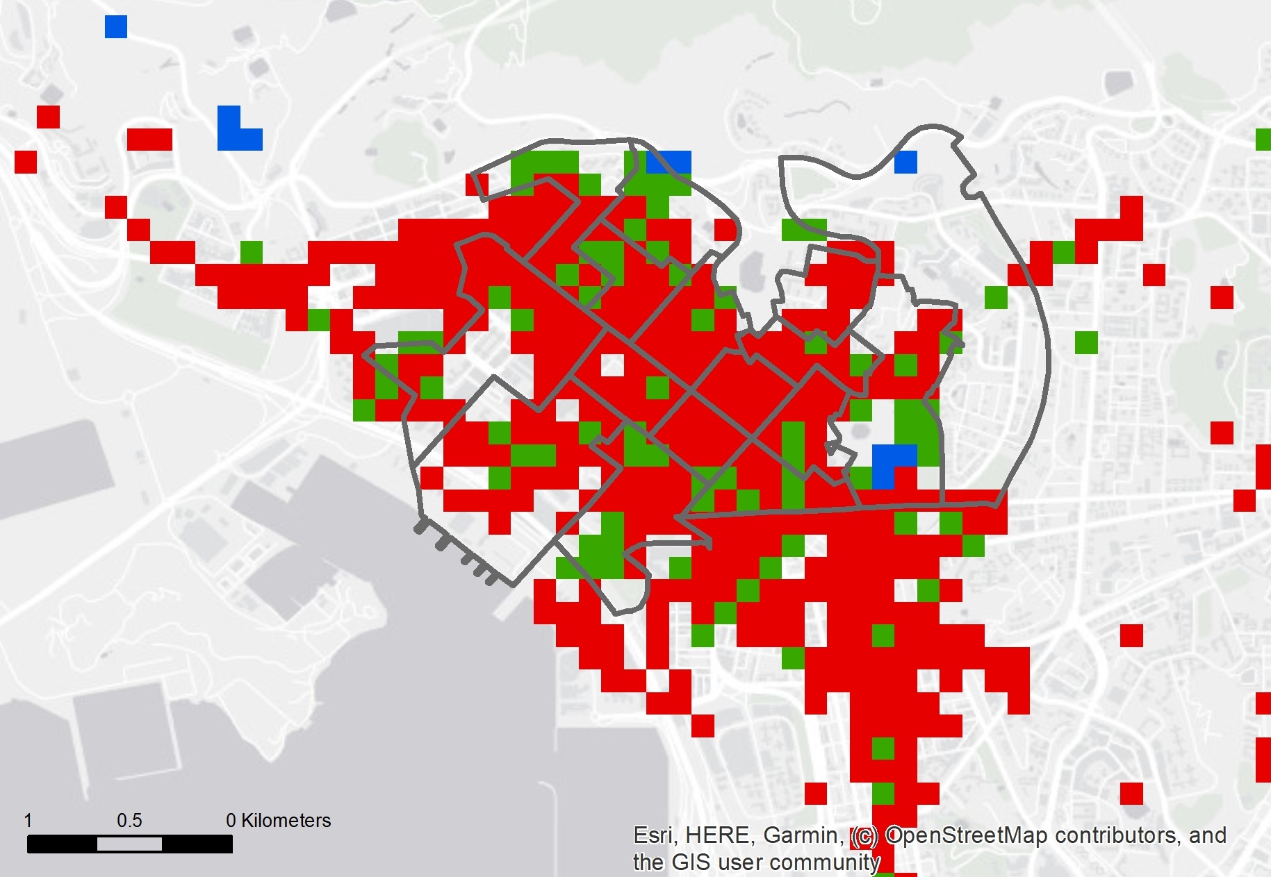
Kan, Z., Liu, D., Yang, X. and Lee, J., 2024. Measuring exposure and contribution of different types of activity travels to traffic congestion using GPS trajectory data. Journal of Transport Geography, 117, p.103896.
Kan, Z., Kwan, M.P. and Tang, L., 2022. Ripley’s K-function for network-constrained flow data. Geographical Analysis. 54(4), pp.769-788.
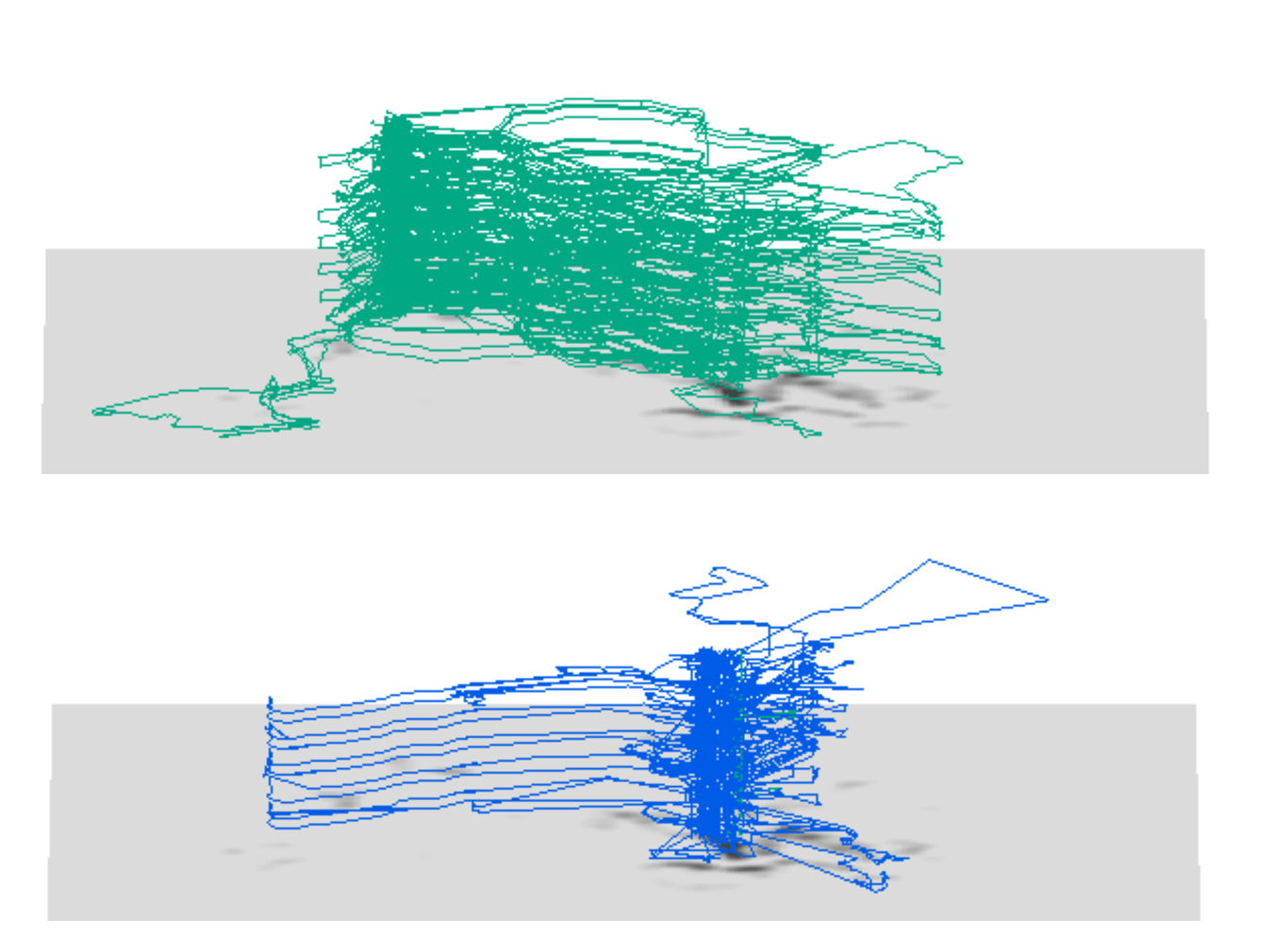
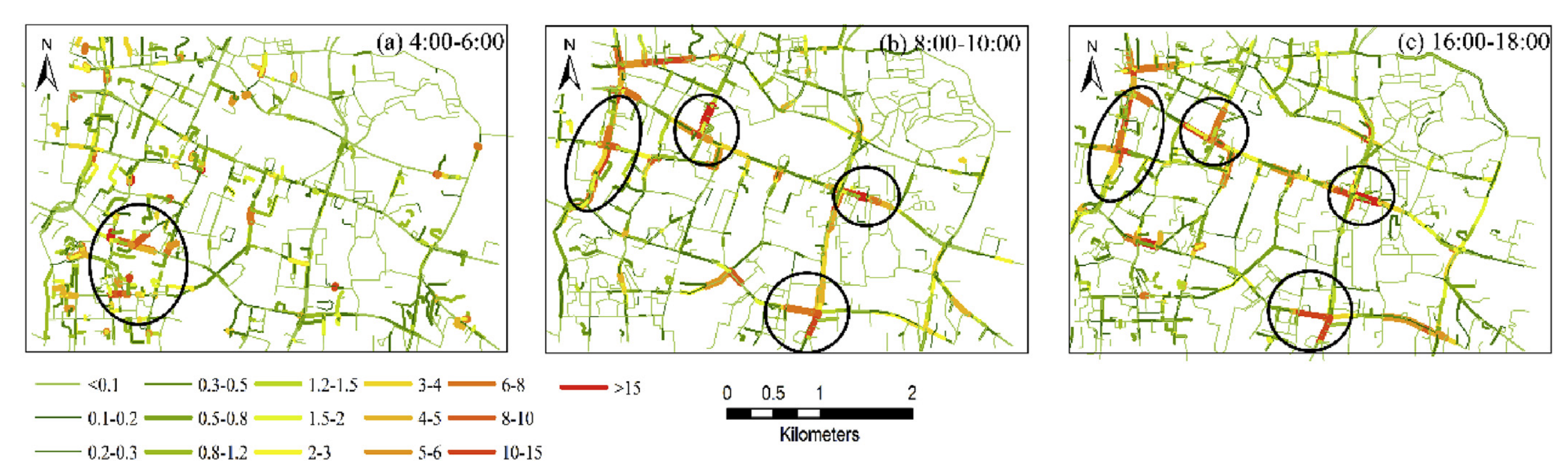
Kan, Z., Tang, L., Kwan, M.P. et al., 2019. Traffic congestion analysis at the turn level using Taxis’ GPS trajectory data. Computers, Environment and Urban Systems, 74, pp.229-243.
Tang, L., Kan, Z.*, Zhang, X., et al., 2016. A network kernel density estimation for linear features in space–time analysis of big trace data. International Journal of Geographical Information Science, 30(9), pp.1717-1737.
Using data collected from mobile sensing technologies such as GPS, air pollution sensors, and noise sensors, my research focuses on investigating individual mobility patterns and their relationship with environmental exposures. I explore the complex interactions between individual mobility, environmental factors, and health outcomes. By analyzing these relationships, I strive to uncover insights into how environmental exposures during mobility impact human health and well-being, awhich may enable evidence-based interventions and policies to promote healthier and more sustainable living environments.
Su, L., Kan, Z*. and Kwan, M.P., 2025. Exploring the factors behind the discrepancy between two-dimensional and three-dimensional indicators of
greenspace exposure. Ecological Indicators, 175, p.113584.
Kan, Z., Kwan, M.P., Huang, J., Cai, J. and Liu, D., 2024. A Spatial Network-Based Assessment of Individual Exposure to COVID-19. Annals of the American Association of Geographers, pp.1-11.
Kan, Z*., Liu, D., Yang, X. and Lee, J., 2024. Measuring exposure and contribution of different types of activity travels to traffic congestion using GPS trajectory data. Journal of Transport Geography, 117, p.103896.
Kan, Z., Kwan, M.P., Cai, J., Liu, Y. and Liu, D., 2023. Nonstationary relationships among individuals’ concurrent exposures to noise, air pollution and greenspace: A mobility-based study using GPS and mobile sensing data. Health & Place, 83, p.103115.
Kan, Z., Kwan, M.P., Liu, D., Tang, L., Chen, Y. and Fang, M., 2022. Assessing individual activity-related exposures to traffic congestion using GPS trajectory data. Journal of transport geography, 98, p.103240.
Kan, Z., Kwan, M.P., Ng, M.K. and Tieben, H., 2022. The impacts of housing characteristics and built-environment features on mental health. International Journal of Environmental Research and Public Health, 19(9), p.5143.
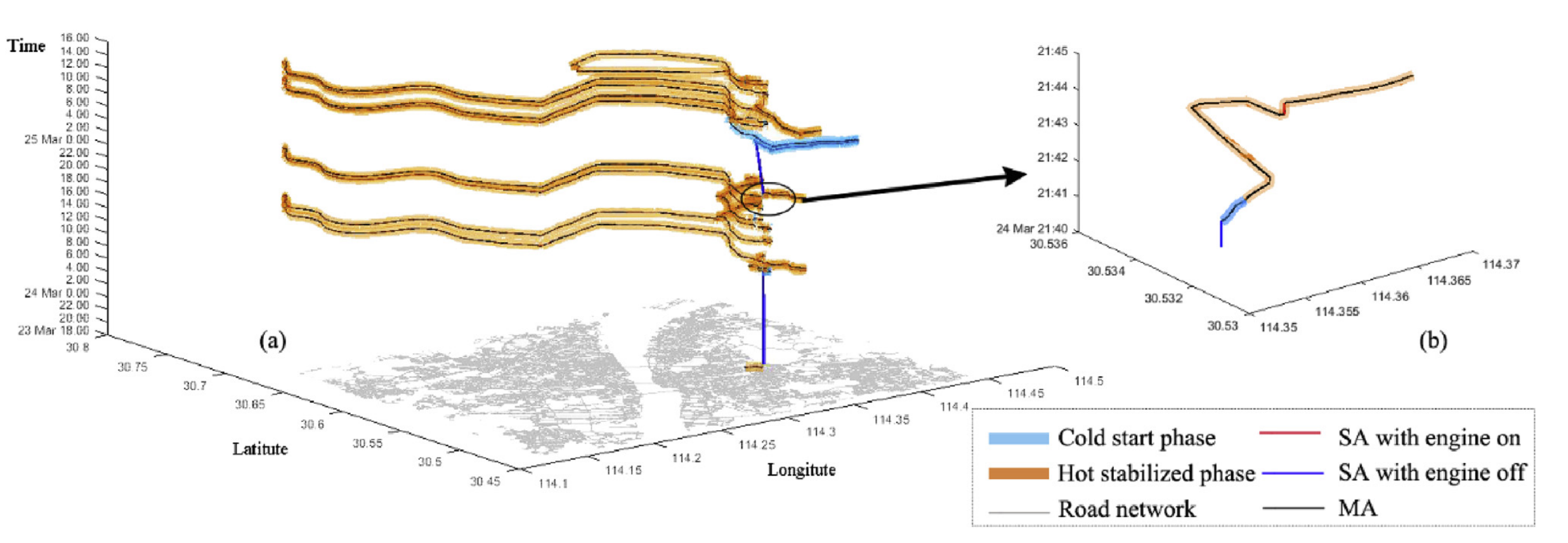
I delve into the dynamics of environmental risks, such as disease transmission risk and air pollution, and explore their potential interactions with human activities and the built environment. Through my studies, I identify regions in Hong Kong with a higher risk of disease (e.g., COVID-19) transmission. By leveraging contact tracing data and a range of geospatial datasets including 3D building data, land cover data, and airborne LiDAR data, I analyze the associated built environment and socioeconomic factors contributing to these risks. Furthermore, using vehicle GPS trajectory data, I investigate the increased risk of vehicle emissions along road networks and assess the impacts of individual vehicle behavior on emission levels.
Kan, Z., Kwan, M.P., Wong, M.S., Huang, J. and Liu, D., 2021. Identifying the space-time patterns of COVID-19 risk and their associations with different built environment features in Hong Kong. Science of the Total Environment, 772, p.145379.
Huang, J., Kwan, M.P. and Kan, Z., 2021. The superspreading places of COVID-19 and the associated built-environment and socio-demographic features: A study using a spatial network framework and individual-level activity data. Health & Place, 72, p.102694.
Kan, Z., Wong, M.S. and Zhu, R., 2020. Understanding space-time patterns of vehicular emission flows in urban areas using geospatial technique. Computers, Environment and Urban Systems, 79, p.101399.
Kan, Z., Tang, L., Kwan, M.P., Ren, C., Liu, D., Pei, T., Liu, Y., Deng, M. and Li, Q., 2018. Fine-grained analysis on fuel-consumption and emission from vehicles trace. Journal of cleaner production, 203, pp.340-352.
Project
2025-2027. Urban Intelligence and Analytics Young Scholar Project. 1+1+1 CUHK-CUHK(SZ)-GDST Joint Collaboration Fund1+1+1 CUHK-CUHK(SZ)-GDST Joint Collaboration Fund. PI.
2024-2026. Sensing “flow patterns of activities” in urban road networks. Young Scientists Fund. National Natural Science Foundation of China. PI.
2024-2025. GreenScan: Unveiling Urban Greenspace Exposure with Street View and LiDAR for Environmental Health Insights. Strategic Partnership Award for Research Collaboration. PI.
2024-2027. Unraveling the complex interplay of objective and perceived greenspace accessibility, greenspace usage patterns, and mental health outcomes in high-density urban environment. Research Grant Council, General Research Fund. PI.
2024-2025. Trip purpose sequence inference and prediction by leveraging large geospatial datasets and GeoAI models. Direct Grant. The Chinese University of Hong Kong. PI.
2023-2024. Investigating the impacts of the living environment of aged buildings on older residents’ out-of-home activities. Direct Grant. The Chinese University of Hong Kong. PI.
2024-2026. Research on spatial clustering method of activity flow in urban road network. Guangdong Provincial Natural Science Foundation. PI.
2022-2025. Start-up fund of The Chinese University of Hong Kong. PI.
2020-2022. The Exposome and Gene-environment Interactions, RGC Postdoctoral Fellowship Scheme. PI.
2023-2024. Vehicle detection and vehicle-kilometrage estimation based on remote sensing technologies. Smart Traffic Fund, Hong Kong Productivity Council and Transport Department. Co-I.
2023-2026. Intelligent portrait of urban pedestrian road network based on multi-modal spatio-temporal big data. National Natural Science Foundation of China. Co-I.
2020-2023. Multi-scale crowdsourcing perception method for urban space based on spatio-temporal big data. National Natural Science Foundation of China. Co-I.